
~ About Stanford Reservoir ~
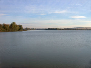 |
| Stanford Reservoir taken from the dam in 2003 |
This page was written in early draft form by Fred Littlemore in 2001 as an introduction to his planned book on Stanford Reservoir. Fred, a regular visitor to Stanford, unfortunately died (4th November 2002) before his book could be published. Updated by John Cranfield.
Geographical position
Stanford Reservoir is situated on the upper reaches of the ‘Warwickshire’ Avon at SP 602805 and lies on the boundaries of Leicestershire and Northamptonshire some 9.65 kilometres from its source in the village of Naseby.
Origins
The reservoir was constructed and formed by flooding a small valley between the villages of South Kilworth and Stanford in the years between 1928 and 1930 by the Rugby Corporation Water Department; as a supply of drinking water for the town of Rugby, some 16 kilometres downstream.
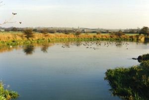 |
| The settling pond with ducks |
The top water level is some110.94 metres (364 feet) above Newlyn datum. The flooding was effected by means of constructing an earth/clay dam across the line of the original river.
The river enters the reservoir via a settling pond at its north-eastern extremity and leaves via a spillway and specially constructed channel below the dam.
Along the northern perimeter (Leicestershire) there is a by-pass and channel, controlled by sluice gates, which allow the water level in the reservoir to be regulated and reduced for repair works etc. and for the flow of water in the river below the dam to be maintained. There is a draw-off tower at the south-western end and below the dam, a pumphouse, toilets and what was previously the Manager’s cottage (now rented out).
In 1958 and 1959 extensions were carried out in enlarging and deepening Blower’s Lodge Bay, thus increasing the original overall area which now extends to some 56 hectares (139 acres). The reservoir grounds increase the overall size of the site to approximately 68 hectares (170 acres). The average width of the water is approx. 300 metres and the overall length some 1.8 kilometres. The capacity at top water level is approximately 500 million gallons.
Close to the dam the water was at its deepest at approx 10 metres but over the years the reservoir has accumulated silt which has now reduced this depth.
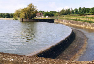 |
| The spillway |
Originally the reservoir was surrounded by inferior quality grassland, some of which was very rough but is now, in the main, surrounded by rich arable farmland. This change occurred during the 1970’s as the original land was drained and more intensive farming methods came into vogue. The surrounding soil is Keuper Marl which is characteristic of the surrounding area.
Drain-off water from the surrounding land also contributes to the overall reservoir content and more recently, as a result of its high nitrate levels, tends to create algae blooms which occur from time to time.
Until the late 1960’s the perimeters of the reservoir were fairly open with very few trees and were mainly composed of Common Reed Mace and Hard Rushes. Since then there has been a general invasion of the perimeter by Sallow bushes, Willows and other species of trees and there are now increasing stands of Phragmities. The growth of vegetation around the water has, over the years, affected the numbers and types of species present, particularly Passerines and Butterflies.
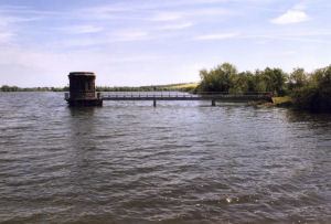 |
| The draw-off tower |
By reference to a map of the United Kingdom it will be seen that the position of the reservoir lies on an imaginary diagonal line drawn between the Wash and the Severn Estuary. As such it also lies on the ‘flyway’ of migrating birds and others that follow the River Avon and then the River Welland valleys and acts as a ‘staging post’ as they cross the country in a north-easterly/ south–westerly direction from coast to coast.
In the earlier years the only other nearby waters were Cropston and Swithland Reservoirs in Leicestershire and Ravensthorpe, Sulby and Naseby Reservoirs in Northamptonshire. During the early years of the Second World War, Eye-Brook Reservoir (164 hectares / 406 acres) on the Leicestershire/Rutland borders was constructed and this was followed by Pitsford Reservoir and Grafham Water in Northamptonshire. The establishment of these, no doubt, influenced what was recorded at Stanford but it was not until the construction of nearby Draycote Water in Warwickshire in 1967 (243 hectares / 600 acres) and the enormous Rutland Water in 1974 (1260 hectares / 3114 acres), that significant changes were noticed and these are apparent when one looks at the list of annual records. Also during these later years numerous local sand and gravel workings were opened as the motorways were extended and two in particular, Shawell and those sections of land immediately adjacent to the reservoir on the North side, had influences on the numbers and varieties of birds that were seen. The latter was eventually filled and returned to agricultural use and the only evidence remaining are the two small sallow fringed pits now used for fishing.
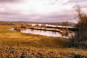 |
| Pools formed by gravel extraction (photo taken in 1981) |
The primary function of the water is as a drinking water supply. From the outset the policies of the Water Boards that have been responsible for its management have been very sympathetic towards wildlife and have maintained that it should be ‘retained as an area of quiet and a bird sanctuary and that any other recreational facilities should be sub-ordinate to this’. The only other activity that has been allowed is that of coarse fishing and the Rugby Federation of Anglers has been allowed to fish from sections of the banks at the east end only, during the open season from June until March. (Approval was given in 2008 for fishing on and around the dam.)
This situation has been maintained throughout and with little disturbance from other activities has, together with the ground cover around the perimeter, made it into an effective sanctuary for birds and other wildlife.
Since its construction, birdwatchers and other naturalists have, with the exception of the wartime years and more recently during the ‘foot and mouth’ outbreak (February to June 2001), been allowed access to visit the Reservoir by Permit. Everyone who has benefited from this privilege is indeed grateful to the Authorities for allowing them to enjoy the tranquillity and peaceful atmosphere that has prevailed and to watch the many species of birds, mammals, butterflies and dragonflies and to look at and study the plants that have occurred there over the years.
Value as an Ornithological Site and Conservation
From the early years when there were fewer open waters in the Midlands, it was realised that (given it sheltered position and location on one of the major migration routes) Stanford Reservoir was important as a haven both for waterfowl and migrating birds.
In these earlier times, representatives from The Rugby Natural History Society and the Rugby School Natural History Society visited the water and kept and published records. After its formation in 1942, and after the wartime restrictions, a few members of the Leicestershire & Rutland Ornithological Society also visited the water and published records in their Annual Report. From the early 1960’s the number of persons visiting the reservoir increased and as a consequence so did the number of records. It was not, however, until 1968 that Northamptonshire birders realised its potential and started collating records in their Annual Report.
At this time, by agreement with Severn Trent Water, the Northamptonshire Trust for Nature Conversation leased an area of approximately 5.5 hectares (13.6 acres) around Blower’s Lodge Bay as a Nature Reserve. This agreement was extended at the end of 1997 when the Water Authority handed over the management of conservation for the whole of the Reservoir to the Trust.
Since that time the Trust have drawn up a draft management plan to protect, improve and enhance the wildlife habitats and biodiversity. They have also taken over the issue of permits for visiting the water.
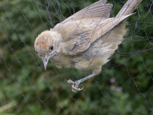 |
| Bird ringing at Stanford |
In 1976 members of the ‘Brandon Marsh (Coventry) Ringing Group’ commenced ringing birds at Stanford and subsequently formed an independent ‘Stanford Ringing and Conservation Group’. Since that time apart from the latter years of the 1980’s, ringing has been carried out on a regular basis and particularly during the Spring and Autumn migrations. The numbers of birds ringed at the site now nears 20,000 (reached 40,000 in 2009) and there have been some very interesting recoveries and re-traps from the site.
Recording
It was not until the late 1960’s that an effort was made to collect all of the observations from regular and casual naturalists by the introduction of a Log Book. Since then an attempt has been made to allow this facility to continue. In 1996 proper log sheets were provided and kept in a loose-leaf binder, housed in a box next to the dam car park.
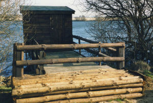 |
| Birdwatching hide |
For a brief period in the 1960’s a temporary hide was erected by Norman Sills on the Leicestershire side of the reservoir on a raised platform supported on posts set into the water. Unfortunately this fell into disrepair, became unsafe and because of its position, looking into the sun, was not popular and was removed.
Sometime in the late 1970’s a more substantial observation hide was constructed and positioned mid way along the Northamptonshire bank at the eastern corner of Blower’s Lodge Bay at its junction with main body of water (Point Hide). Another one was erected early in 1990, also on the Northants side, at the western edge of Blower’s Lodge Bay. [This hide was demolished in 2011 on Health & Safety grounds.]
 |
| Fred Littlemore |
Fred was a member of the Leicestershire & Rutland Ornithological Society for over 40 Years, becoming Chairman in the early 1970’s and President in 1997. An organiser of the wildfowl counts for the county on behalf of the Wildfowl & Wetlands Trust.
A regular visitor to Stanford for over 40 years, his publication was to cover butterflies, dragonflies, mammals and plants as well as the many bird species recorded there.
Below, Fred recalls the background to nature recording at Stanford Reservoir -
"My
first visit was in the Autumn of 1962 and since then I have been going
to the water on a regular basis and collecting records. Since
1963 I have also been responsible for carrying out the Wildfowl Counts
at the Reservoir for the Wildfowl & Wetlands’ Trust.
Towards the end of the 1960’s the numbers of visiting birders increased and as a consequence, the numbers of records and variety of birds being seen, also increased. At the end of this decade Norman Sills, who had been visiting the water from about the same time as me, published a booklet entitled ‘Birds of Stanford Reservoir 1933 – 1967’ Also at about this time, two members of the Rugby School Natural History Society, D. N. Mirecki & R. W. A. Leslie, published a paper entitled ‘Bird Watching in Central England’. Also in 1987, Andrew Strang prepared a paper entitled ‘Stanford Reservoir – an Ornithological Guide’.
It was not until the late 1960’s that an effort was made to collect all of the observations from regular and casual naturalists by the introduction of a Log Book. Since then an attempt has been made to allow this facility to continue. In 1996 proper Log sheets were provided and kept in a loose-leaf binder, housed in a box next to the car park.
Since then, the interest in Ornithology and Conservation generally has increased beyond recognition and as a consequence, so have the numbers and variety of species recorded. This interest did not, however, extend to the same extent in the recording of other vertebrates and invertebrates. In the case of Mammals, I do not believe there are many records before those of the early 1970’s. In the case of Butterflies, few records exist before 1974 and similarly, records between 1985 & 1992 were not as numerous. In the case of Dragonflies, it was not until 1991 that any records were left."